1887 plat map
Map copied from Illustrated Historical Atlas of the State of Indiana, Baskin, Forster & Co, Chicago, 1876
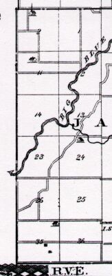
Hendricks Twp is to the north, Washington Twp to the east, Bartholomew Co to the south and Johnson Co to the west.
1887 plat map
| 6 | 5 | 4 | 3 Johnson Co | 2 Atwood Sanders Cutsinger Dritt Shipp Webb Bass | 1 Beeson Hayes Shaw Phillips Cutsinger Dritt Sanders 7
| 8
| 9
| 10 Johnson Co
| 11 Brockman Scott | Cutsinger Duckworth Harrington Sanders Major 12 Crump Cutsinger | Owen Smith Scott VanGordon Perry Hill 18
| 17
| 16
| 15 Johnson Co
| 14 Sanders | Perry Deupree Thompson 13 Kelly Barlow | Perry Conover Clark 19
| 20
| 21
| 22 Johnson Co
| 23 Deupree | Thompson Young Cutsinger 24 Cutsinger Goff | Cutsinger Clark Muck Engler Graham 30
| 29
| 28
| 27 Johnson Co
| 26 Baker Wright | Cutsinger Legate Cutsinger 25 Snepp Rinehart | Legate Mahley Webb 31
| 32
| 33
| 34 Johnson Co
| 35 Roth Baker | Frost 36 Snepp Shade | Pruitt Drake Legate |
The above table is for a general overview of the neighborhood. The Recorder's Office has a description of the location and amount of land owned by each individual.
Original purchases for T11N R5E