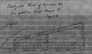
the section to the right is east of N. Harrison, just
south of the Big Blue River.
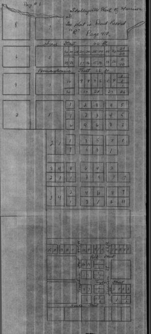
The indented area to the left is the
west half of the Public Square.
N
W E
S
W E
S
Shelbyville Maps
Addison Township
Township 12 & 13 North - Range 6 & 7 East
| Although the map is labelled "West of Harrison St," the section to the right is east of N. Harrison, just south of the Big Blue River. |
|
|
| The indented area to the left is the west half of the Public Square. N
W E S |