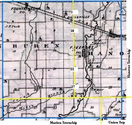
Map copied from Illustrated Historical Atlas of the State of Indiana, Baskin, Forster & Co, Chicago, 1876
The yellow lines mark the present day townships - VanBuren (west), Hanover (east) and Addison (south).
State Road 9, non-existent when this map was drawn, runs north and south from Shelbyville to Greenfield, just east of Fountaintown
The bottom blue line represents County Road 600 North; the top would be 1200N.
The left blue line represents County Road 100 West; the right would be 500E.